Hurricane Season 2014: Using Technology to Stay Safe
Making travel plans this summer? You should know that if you're scheduling a family vacation at a beach during hurricane season, you're taking your chances. After all, there’s a reason rates are discounted.
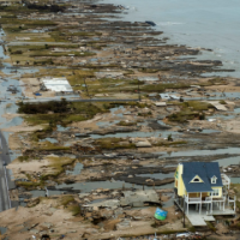
Hurricane season in both the North Atlantic and the Pacific lasts until the end of November, and it’s no fun watching pouring rain and crashing waves from your hotel window—or crawling along in bumper-to-bumper traffic during an evacuation. There’s also the threat of damage from storm surge caused by the strong winds in a hurricane or tropical storm.
The National Oceanic and Atmospheric Administration (NOAA) is predicting good news for the 2014 Atlantic hurricane season: El Niño is expected to develop and suppress the number and intensity of tropical cyclones, resulting in a near-normal or below-normal season.
However, it only takes one.
In NOAA’s announcement, Kathryn Sullivan, Ph.D., NOAA administrator stated, “And even though we expect El Niño to suppress the number of storms this season, it’s important to remember it takes only one land falling storm to cause a disaster.”
FEMA Associate Administrator for Response and Recovery Joe Nimmich concurred. "It only takes one hurricane or tropical storm making landfall to have disastrous impacts on our communities. Just last month, Pensacola, Florida saw five inches of rain in 45 minutes – without a tropical storm or hurricane.”
Last year, the National Weather Service unveiled “Tide” and “Gyer”—two new weather supercomputers designed to more accurately project storm intensity and structure. For the 2014 hurricane season, NOAA is rolling out a Potential Storm Surge Flooding map to show coastal areas where storm surge could occur and how high above ground the water could reach.
According to NOAA, the map will be issued when a hurricane or tropical storm watch is announced for areas along the Gulf or East Coast or approximately forty-eight hours before the expected onset of tropical storm force winds. Note that due to processing time, the maps won’t be available until approximately forty-five to sixty minutes following the release of an advisory.
Below is a list of resources to help you stay safe during the 2014 hurricane season.
- NOAA on Twitter
- Atlantic Tropical Cyclone Feed: @NHC_Atlantic
- Eastern Pacific Tropical Cyclone Feed: @NHC_Pacific
- Storm Surge Feed: @NHC_Surge
- Your local @NWS office https://twitter.com/NWSNorman/lists/nws-on-twitter
- NOAA on Facebook
- To access the latest weather watches and warnings from your phone or tablet, bookmark www.hurricanes.gov/mobile.
- The Potential Storm Surge Flooding map will be part of an interactive display made available on www.hurricanes.gov.
- FEMA.gov
- Learn how to prepare for hurricanes at www.ready.gov/hurricanes.